Reading Digital Sources
Statistics and Statecraft in 19th-century America
Benjamin MacDonald Schmidt
2015-04-01
Paths of American Vessels, 1789-c.1860
International Comprehensive Oceanic and Atmospheric Database icoads.noaa.gov
Whaling Logbooks
Matthew Maury
Confederate Navy Engraving 1862, from http://www.history.navy.mil/library/online/maury_mat_bene.htm
Abstract Logbooks
Undigitized Logbook material
Matthew Maury's Wind and Current Charts
Reconstructed Shipping Times

Deck 701, US Maury Collection (1789-c.1865)

Deck 701, US Maury Collection (1789-c.1865)
Deck 892, US shipping 1980-1997
Logbook Digitization in the 1920s
Wallbrink, H. and F.B. Koek, Data Acquisition And Keypunching Codes For Marine Meteorological Observations At The Royal Netherlands Meteorological Institute, 1854–1968
Digitized logbooks, c. 1930
Wallbrink and Koek
ICOADS Deck 720, German weather data, 1876-1914

ICOADS Deck 735, Russian Research Vessels
Closeup of Deck 735. Soviet Vessels near the coast of South America.
ICOADS Deck 735, Russian Research Vessel (R/V) Digitisation
German Deep Drifter Data (via ISDM; originally from IfM/Univ. Kiel)
1790
1800
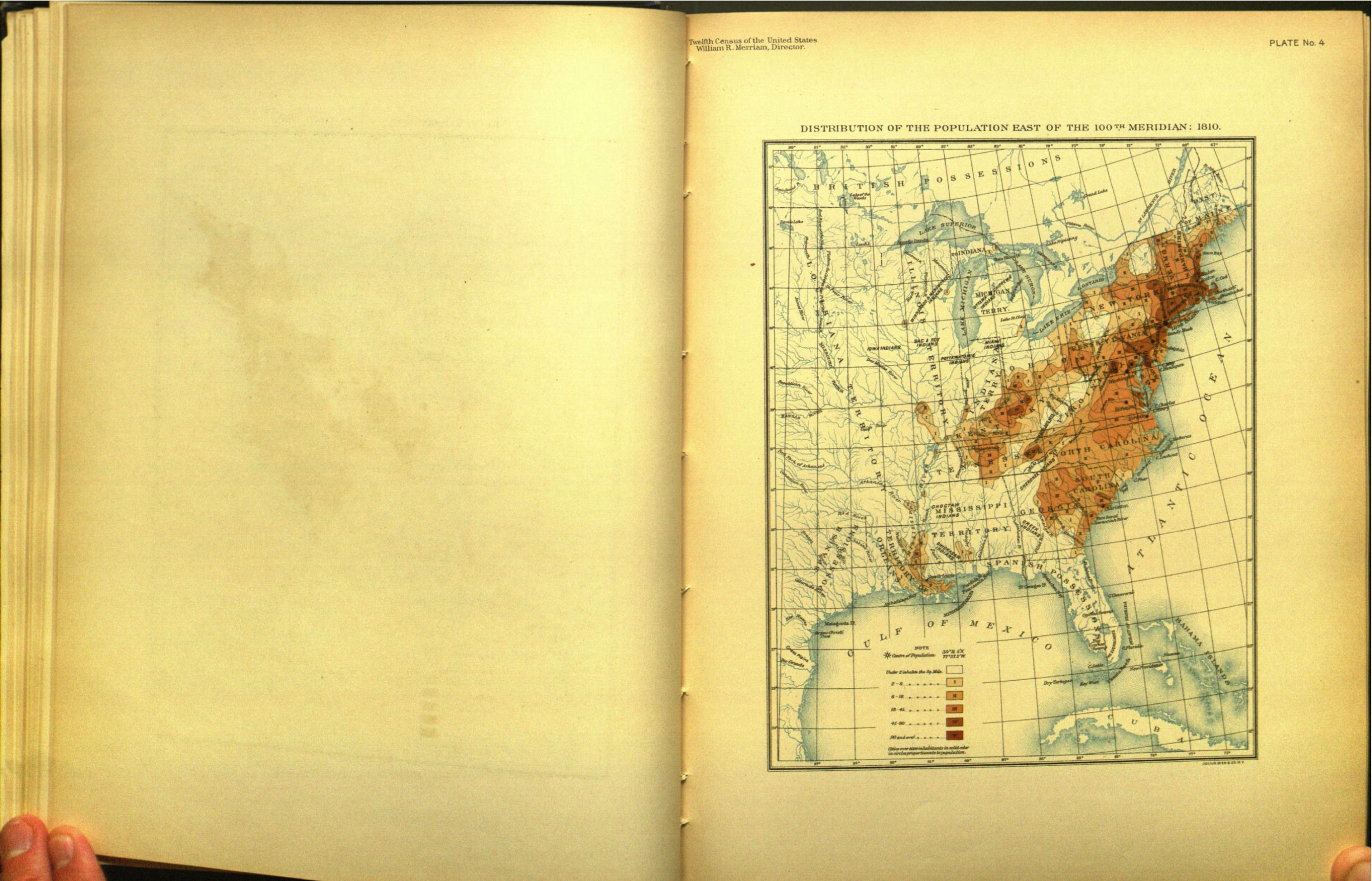
1810
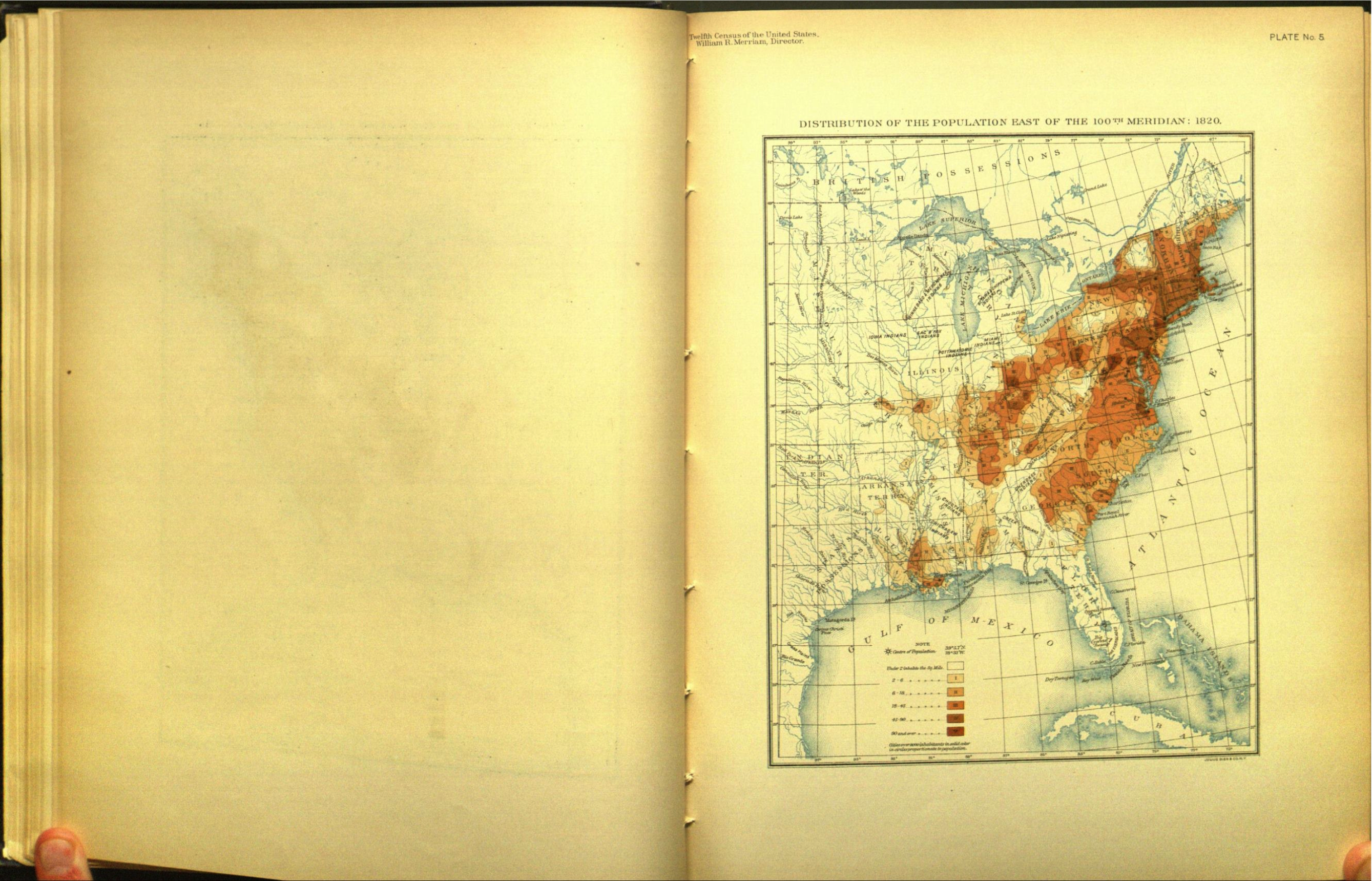
1820
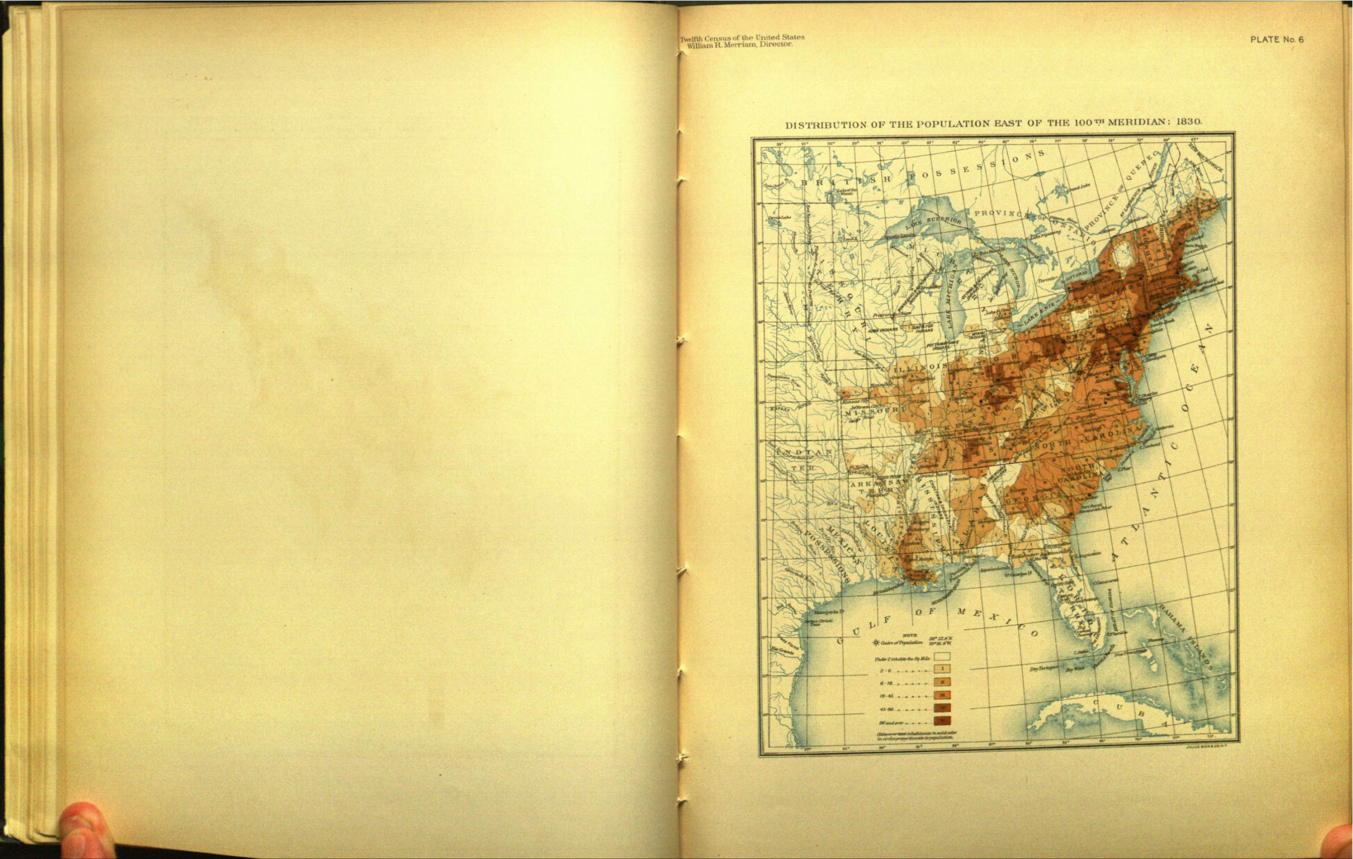
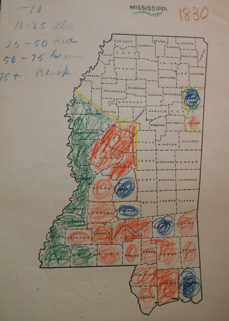
1830
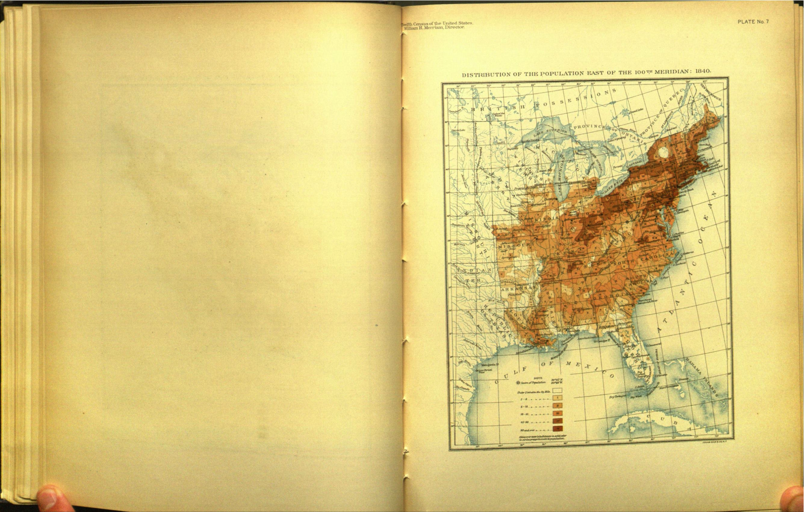
1840
1850

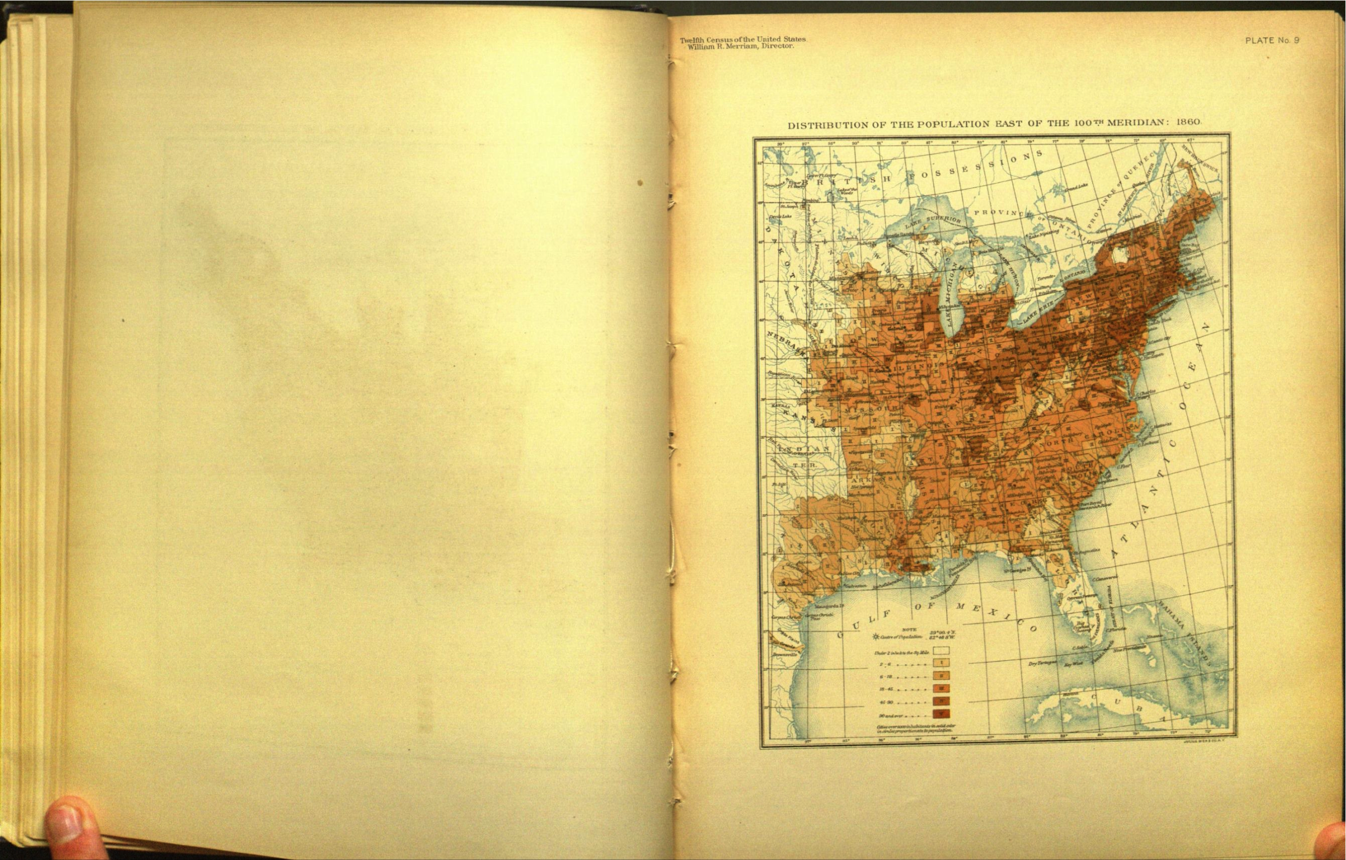
1860
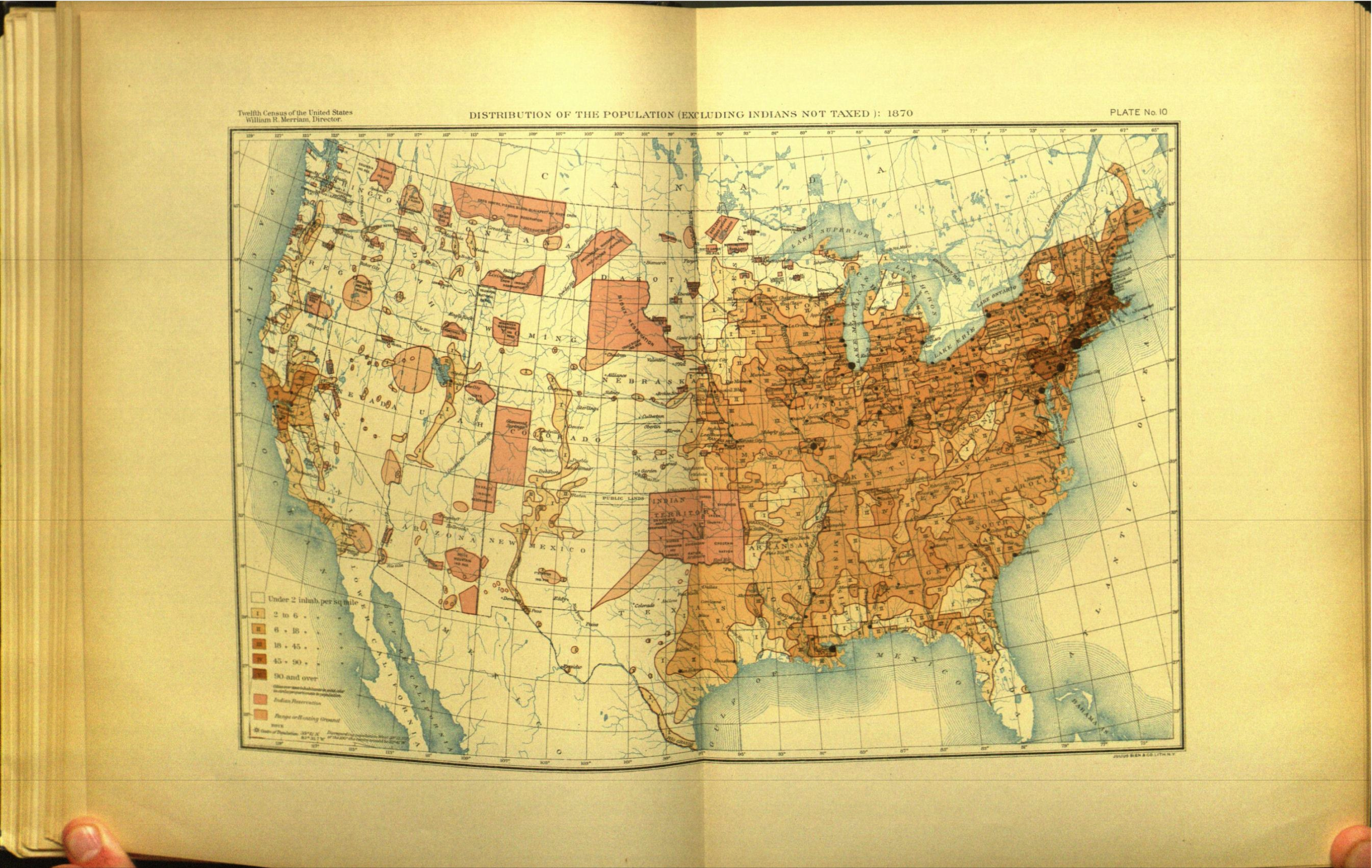
1870
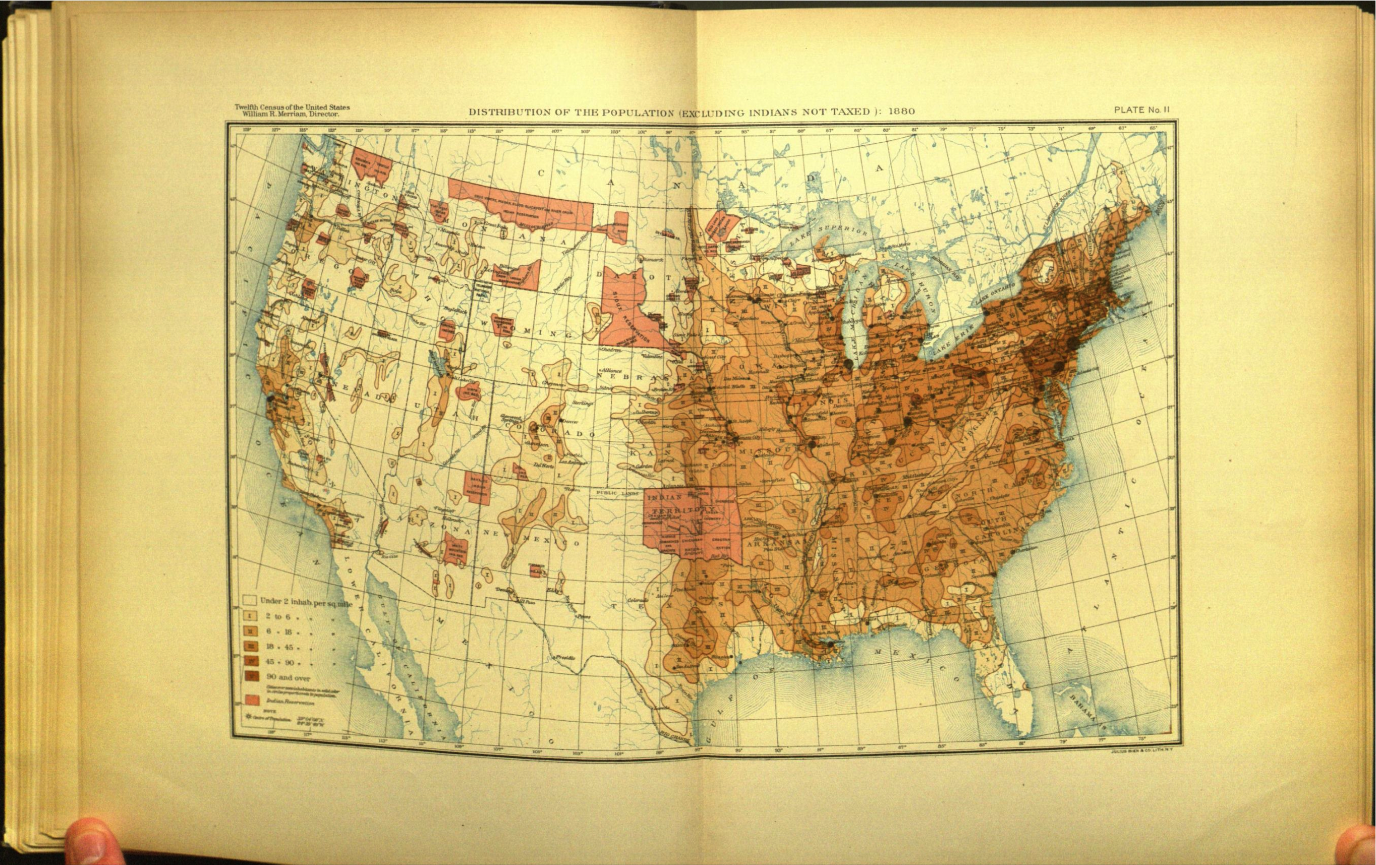
1880
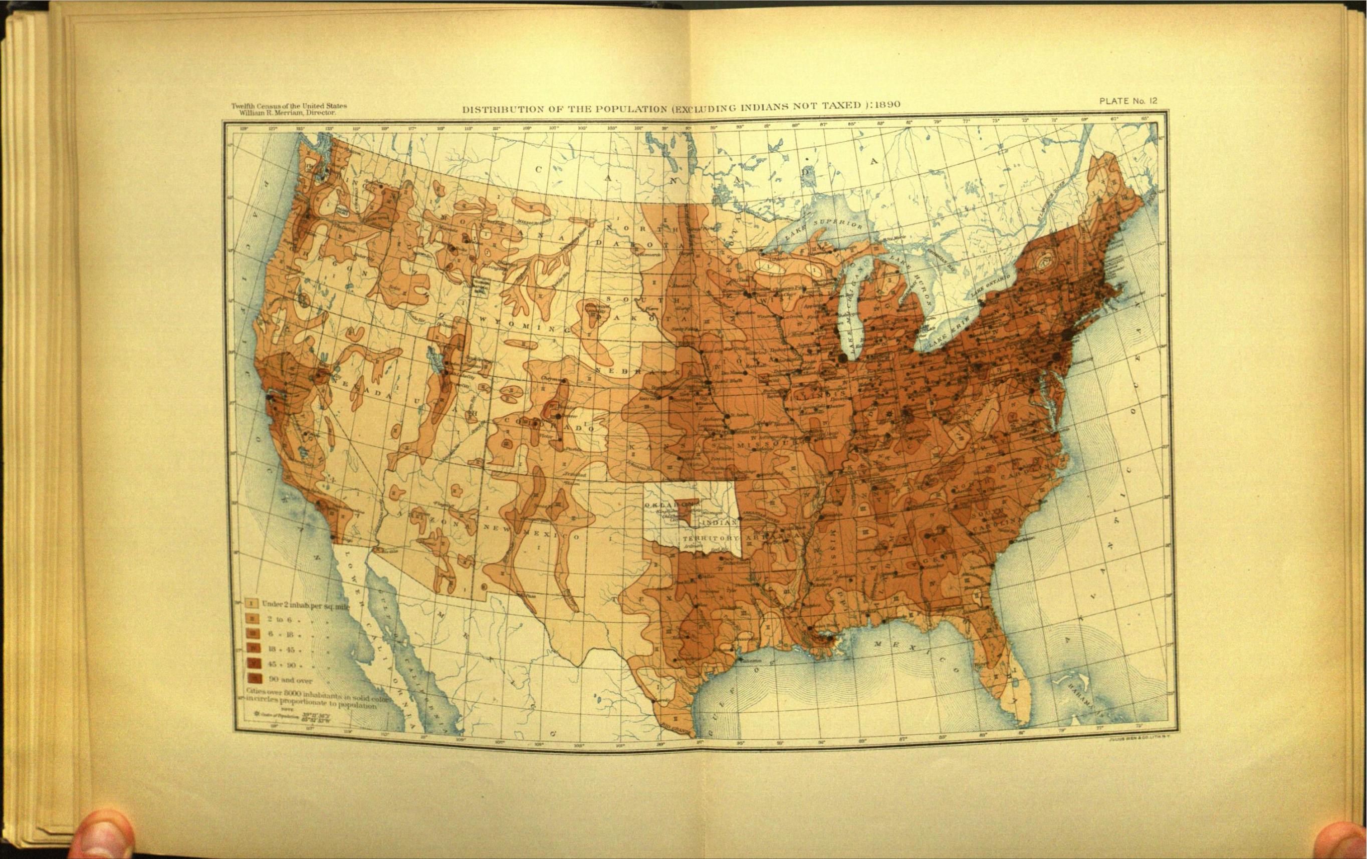
1890
Vallandingham
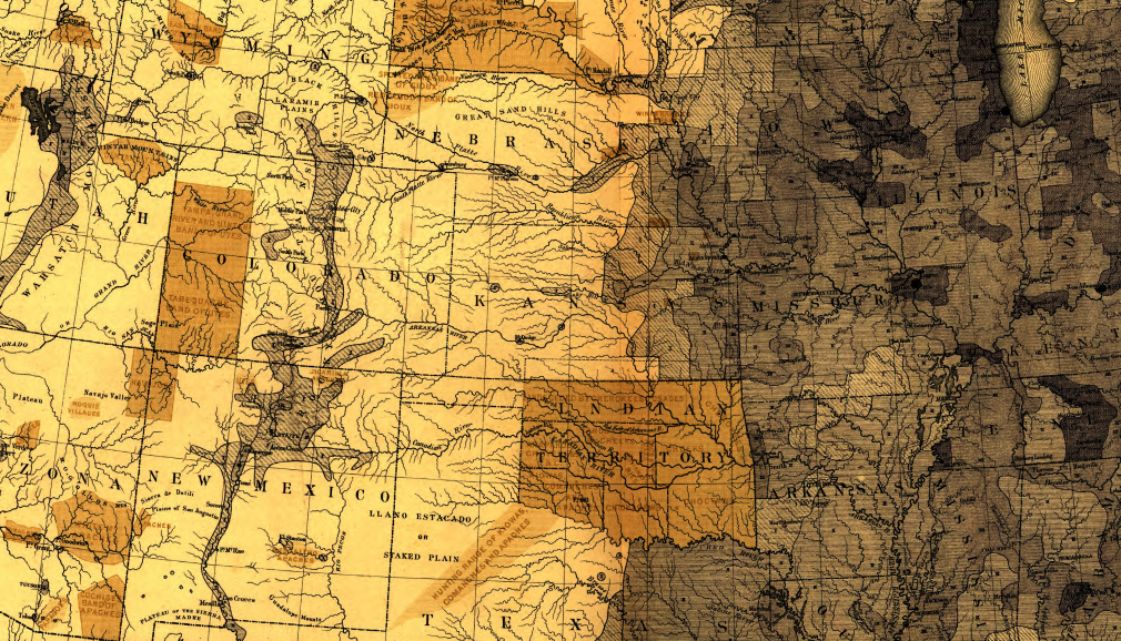
Census atlas chic

1870 Census atlas, detail
Raw templates for sending maps to printer, 1900 census (National Archives)

1880
1890
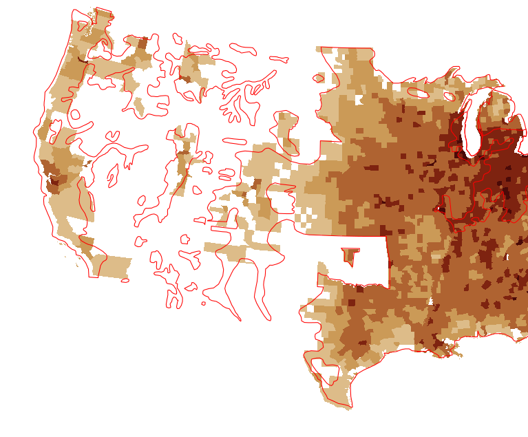
Georeferencing and training

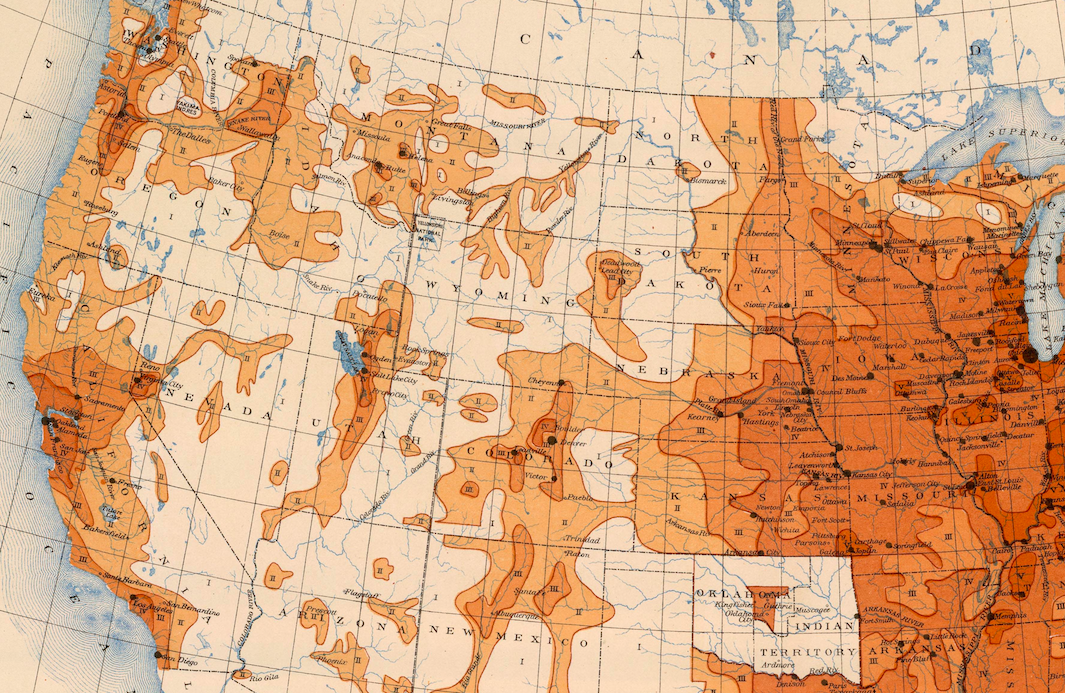
Census frontiers (red) vs county boundaries
1900
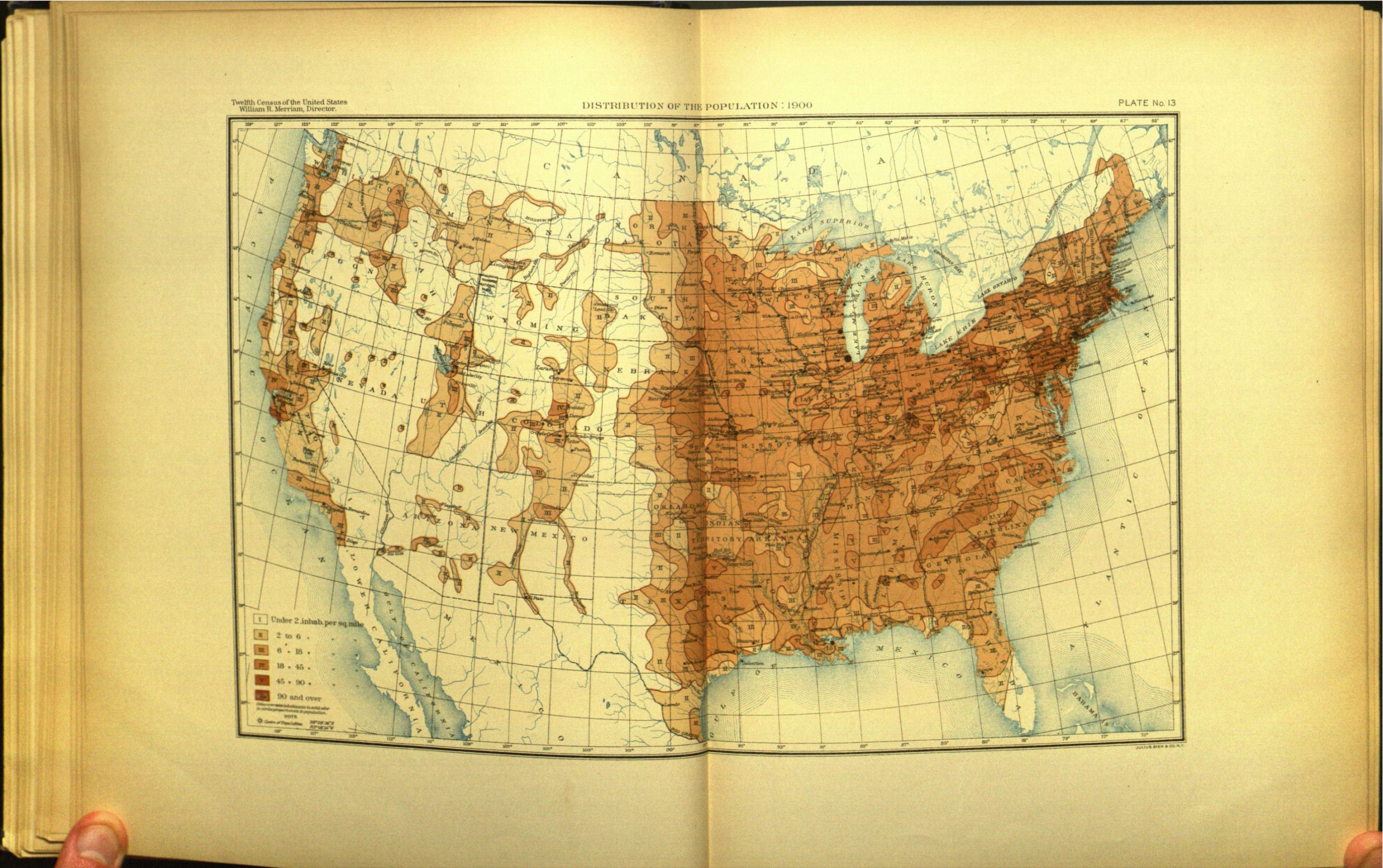
County data, 1930(?) atlas: National Archives
Charles Paullin Historical Atlas, 1932

David Rumsey Historical Maps
Madison Grant, Passing of the Great Race, 1916

1890 Frontier map, closeup
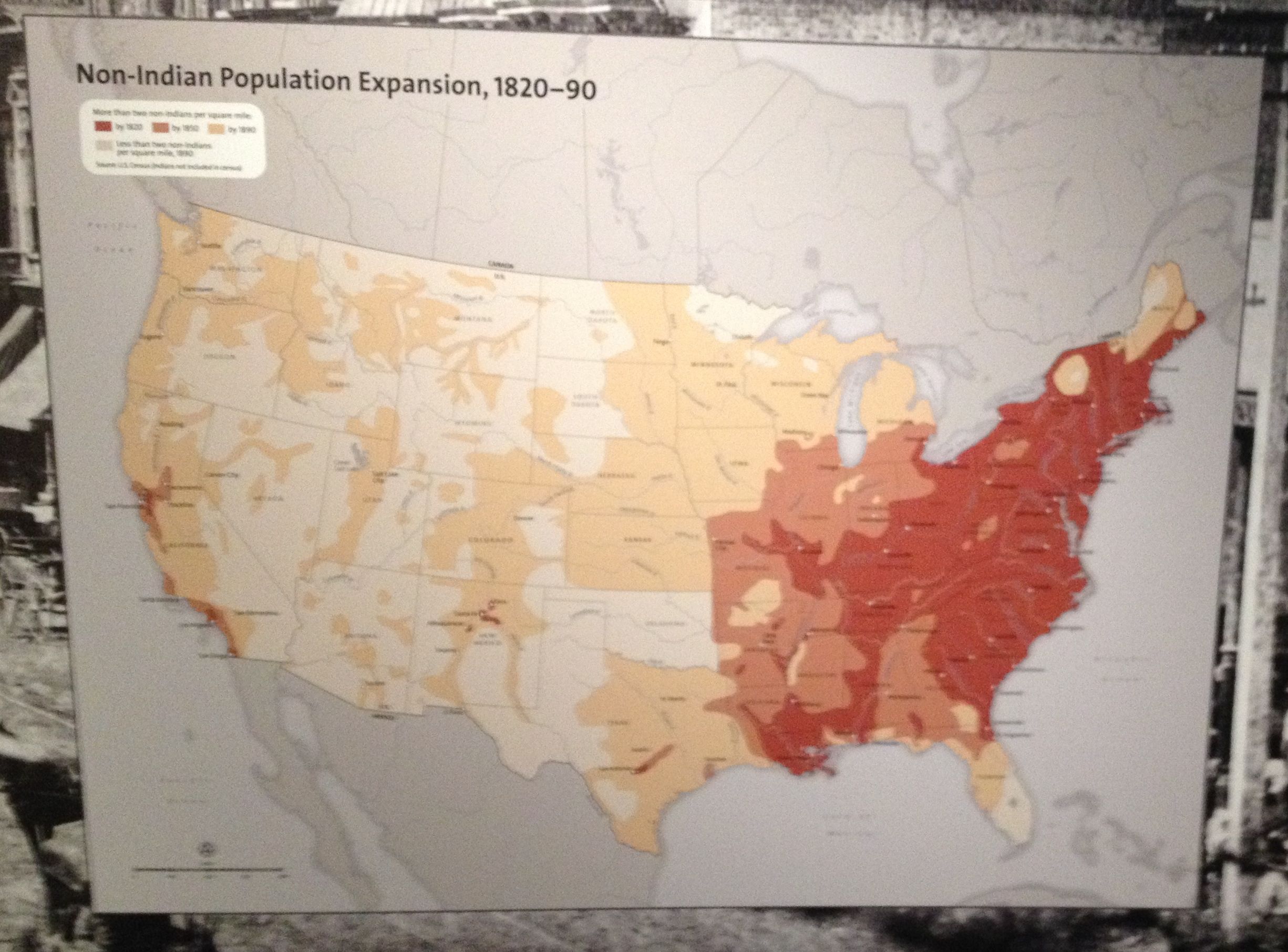
National Museum of the American Indian, 2014
Turner, "Western State Making in the Revolutionary Era:" AHR, Volume 1, Issue 1 
02138
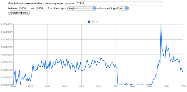
02138
Google's partner libraries shift in 1900, 1922, and later