Reconstructing the Map

Benjamin MacDonald Schmidt Assistant Professor of History, Northeastern University Core Faculty, NuLab for Texts, Maps, and Networks

May 2015

Overview

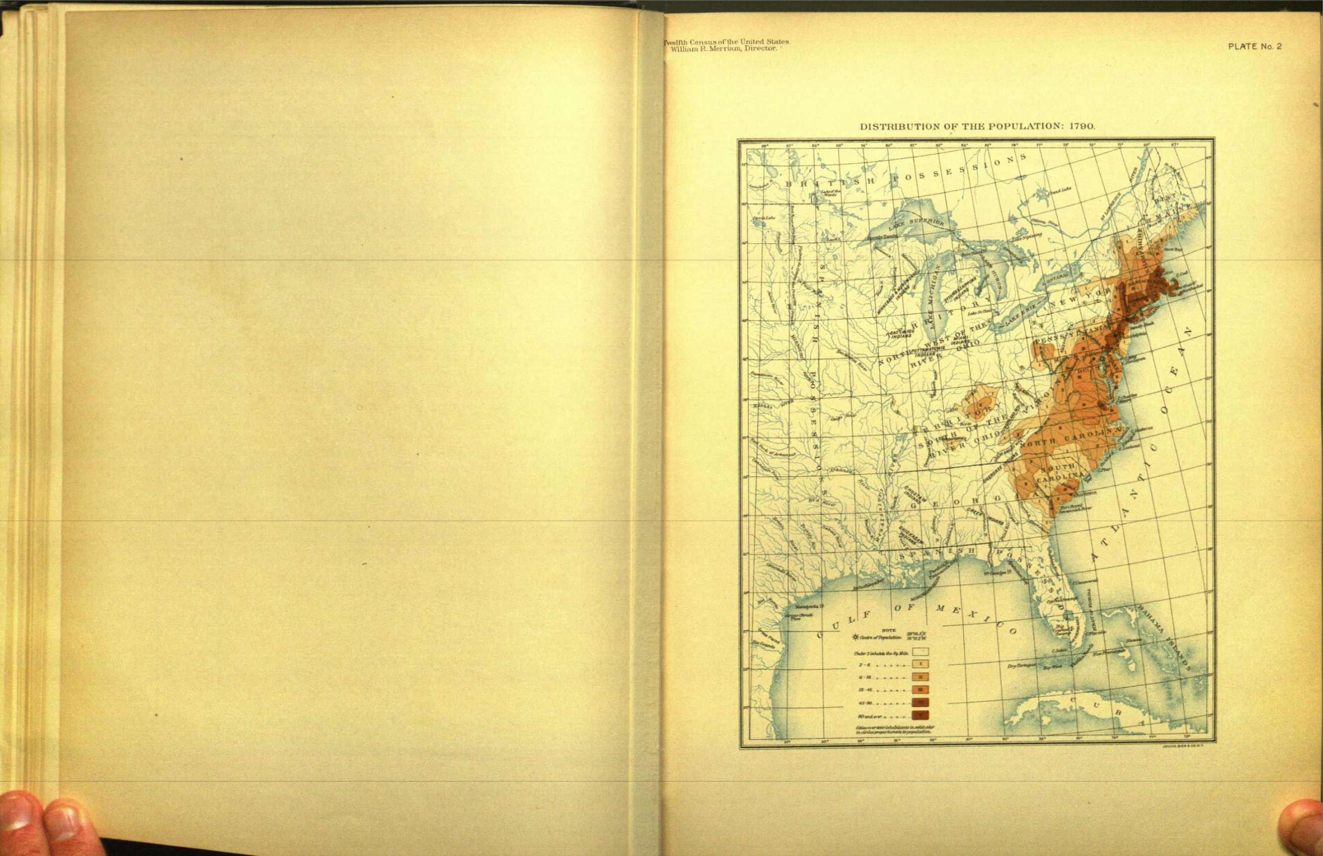
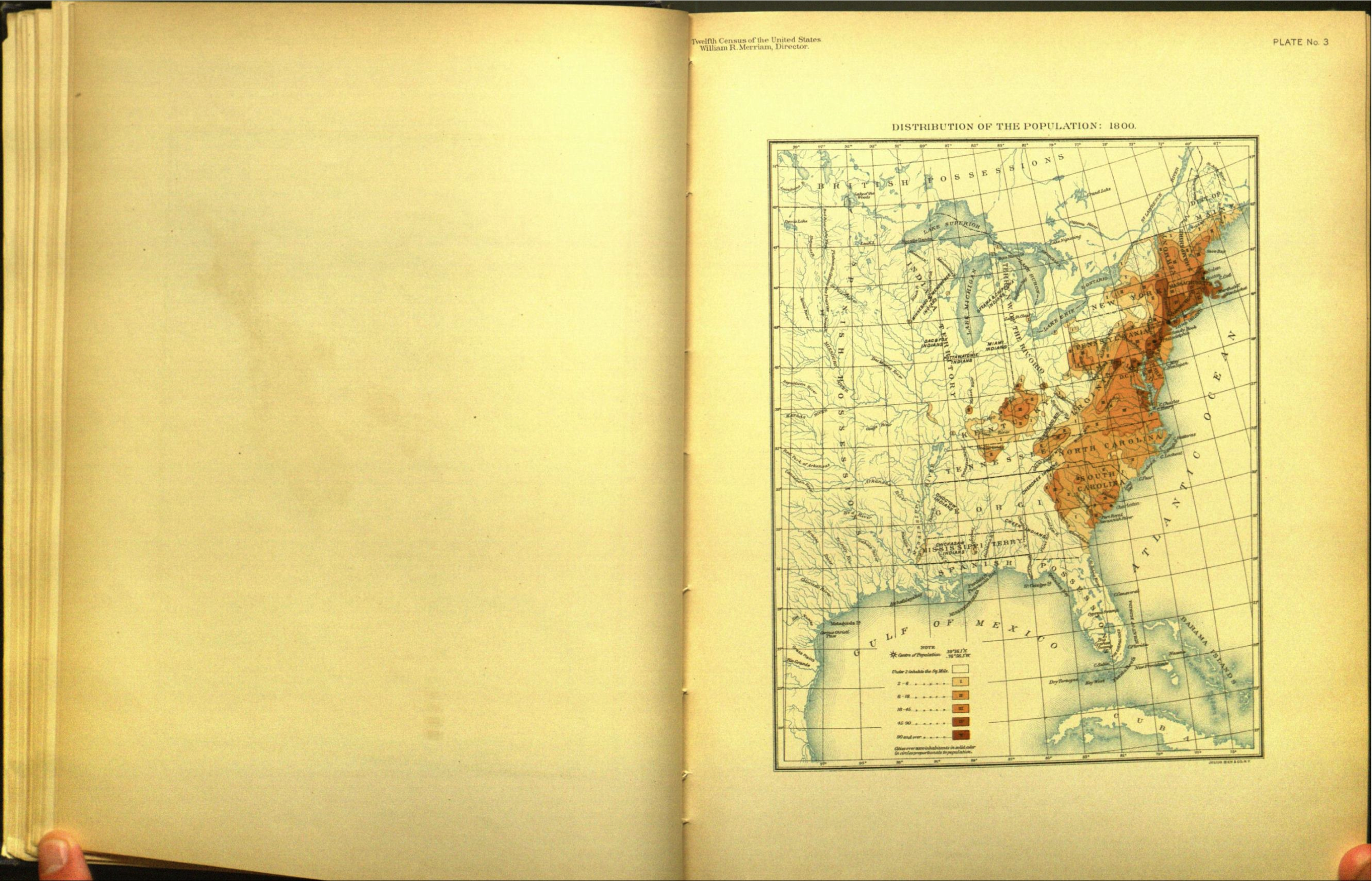
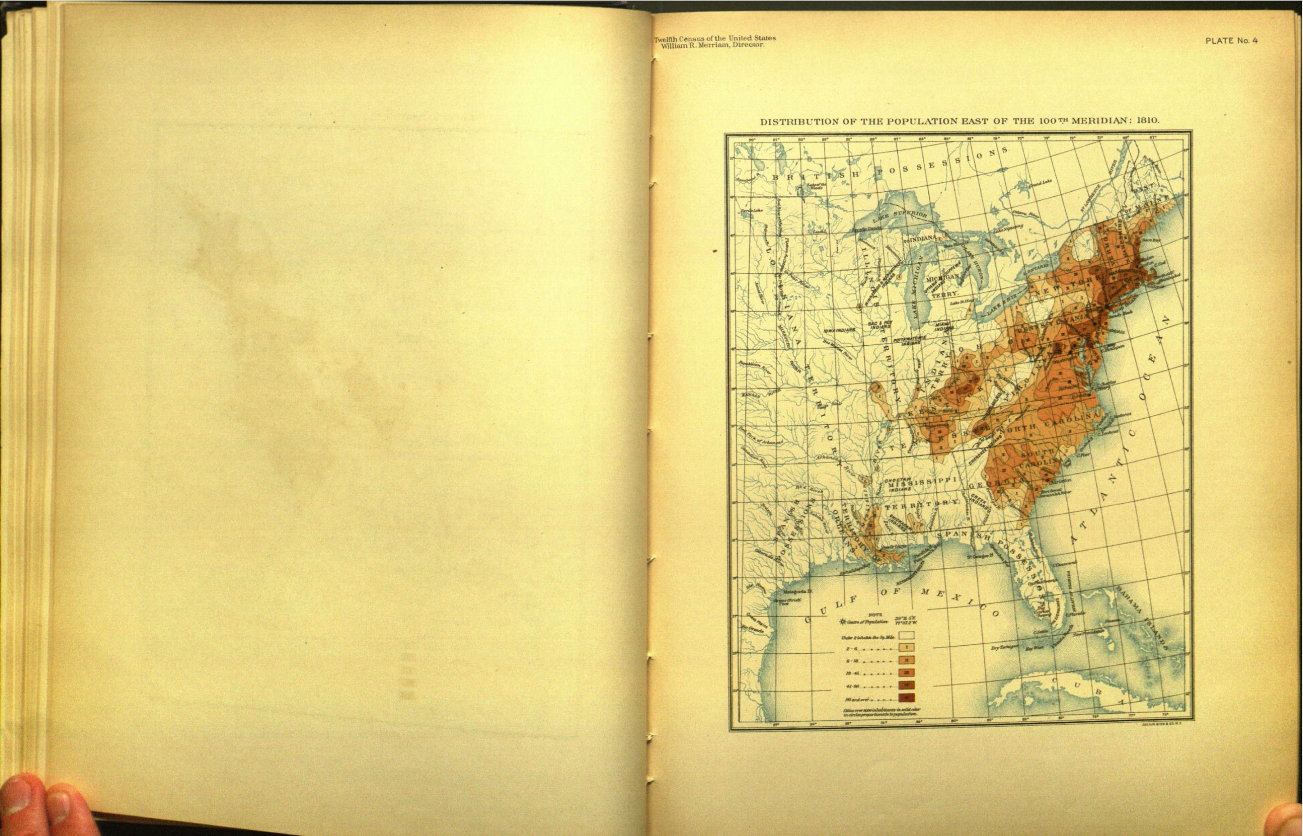
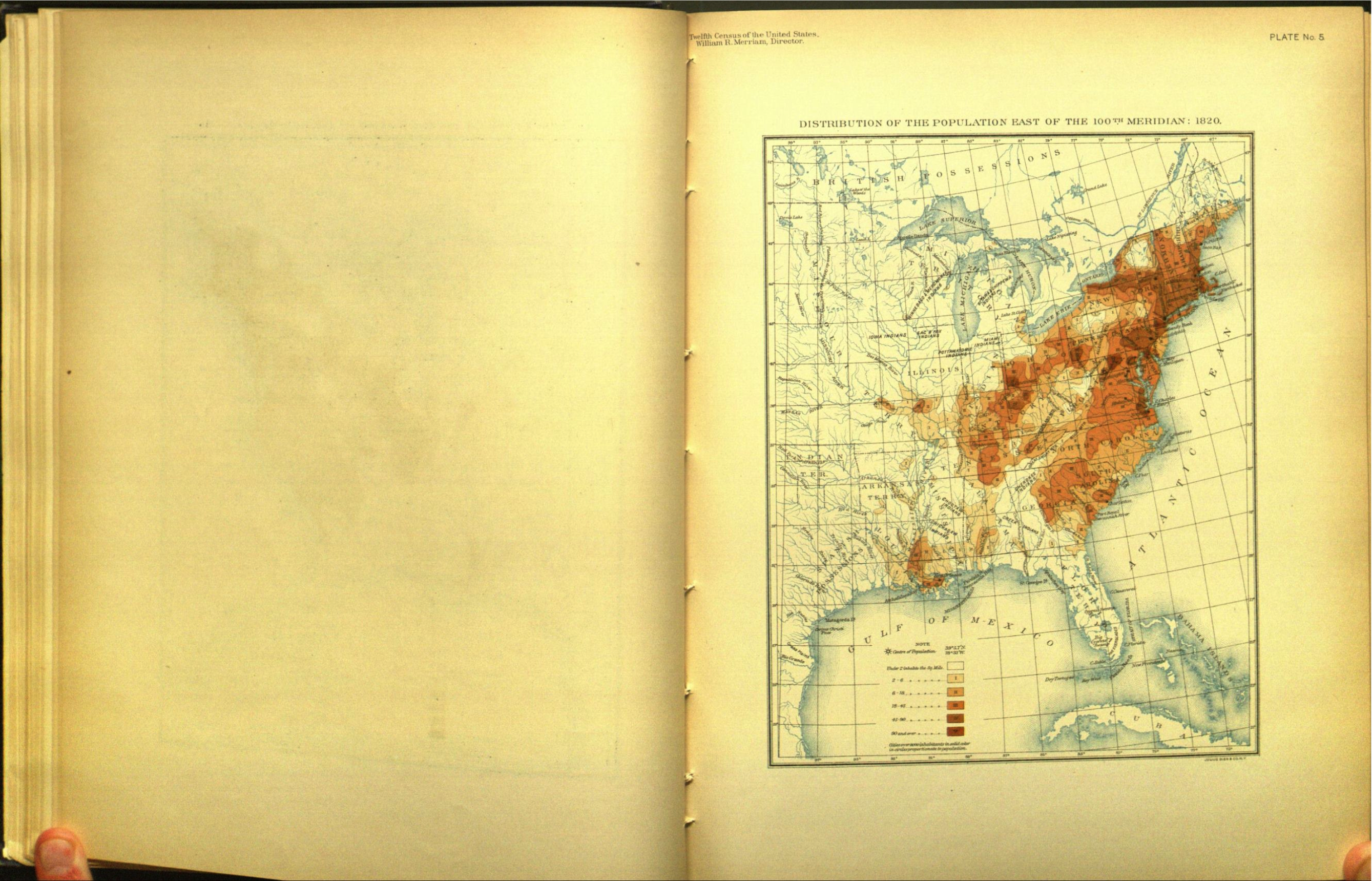
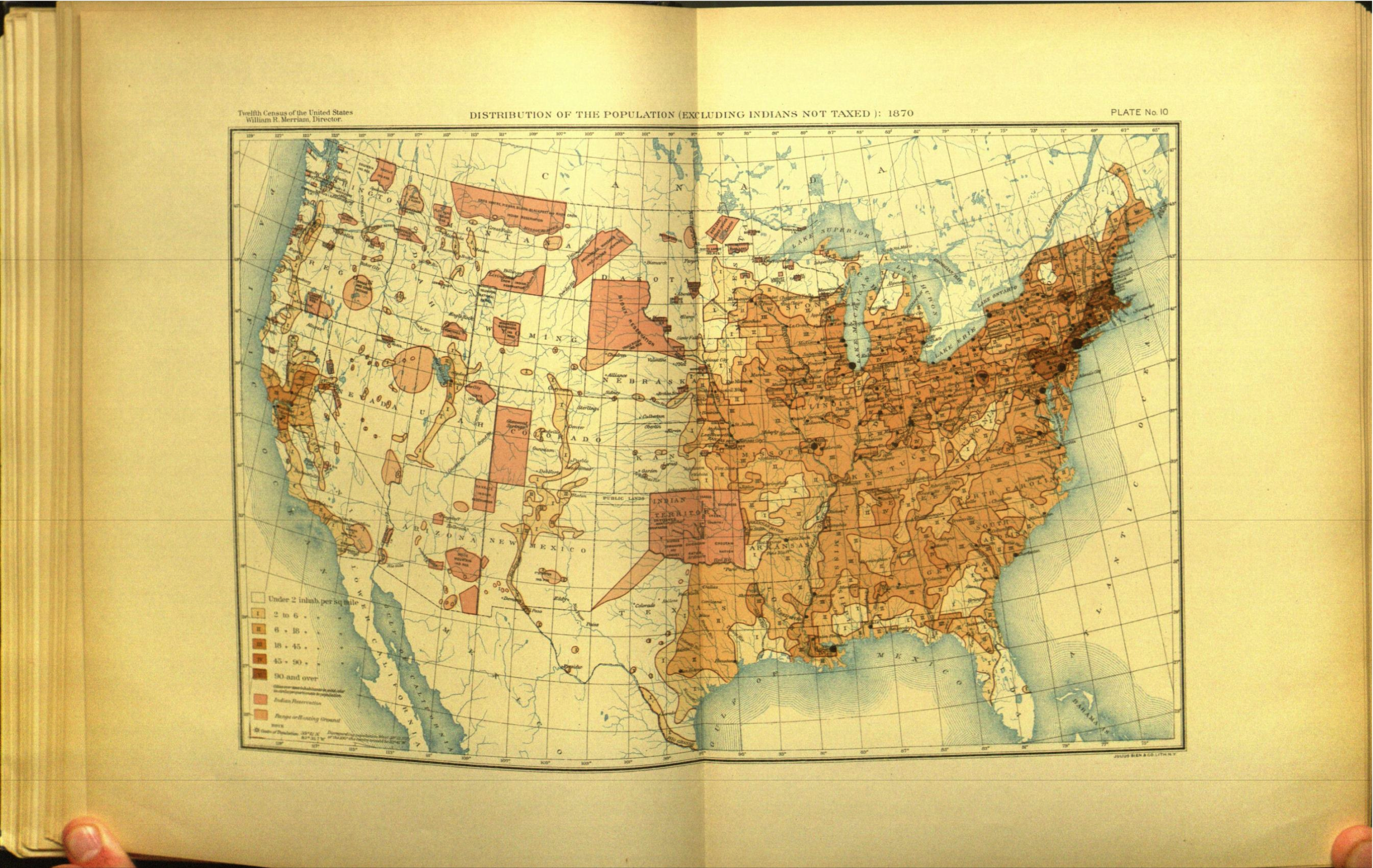
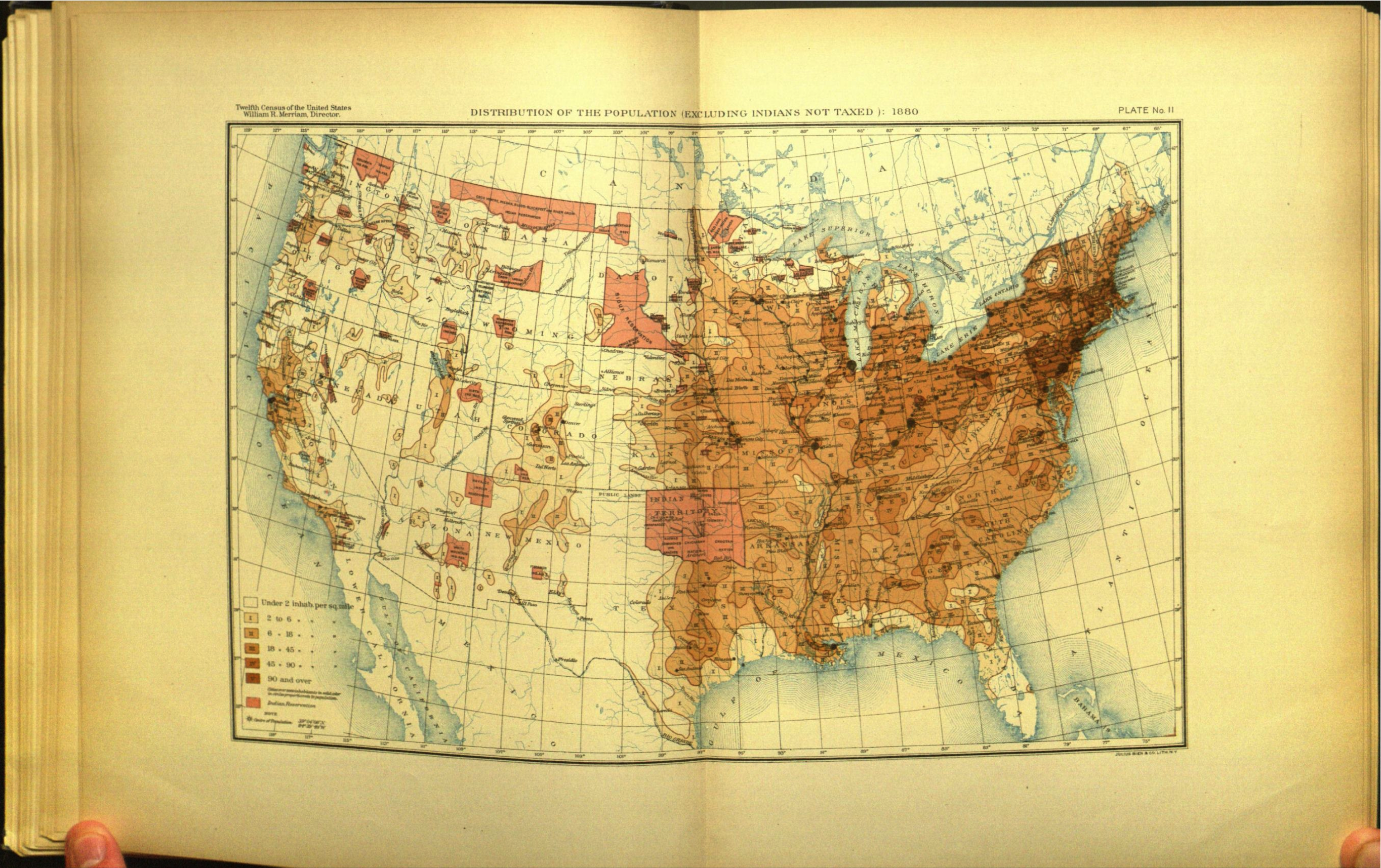
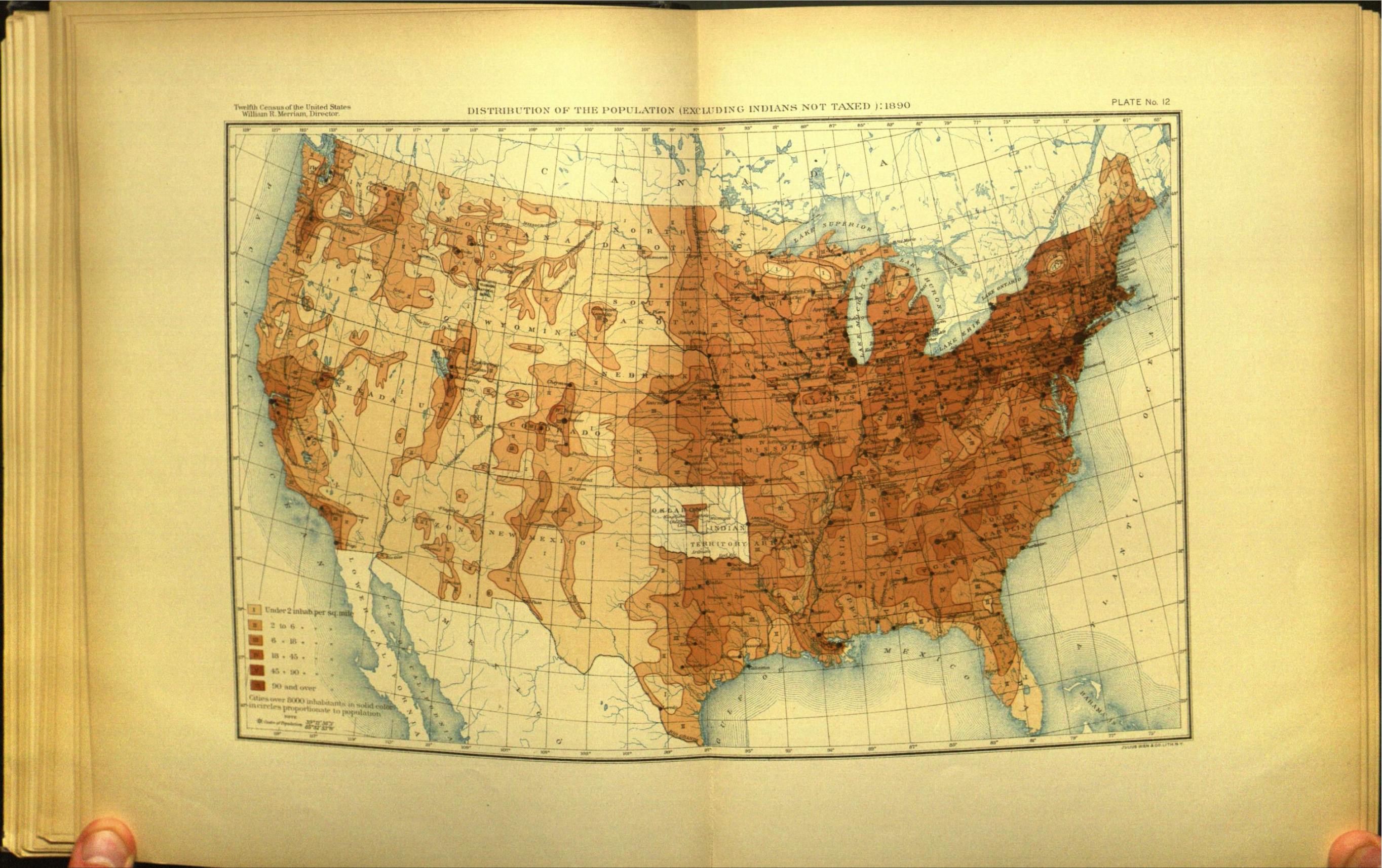
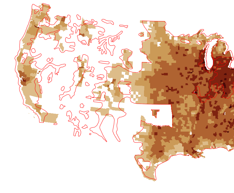
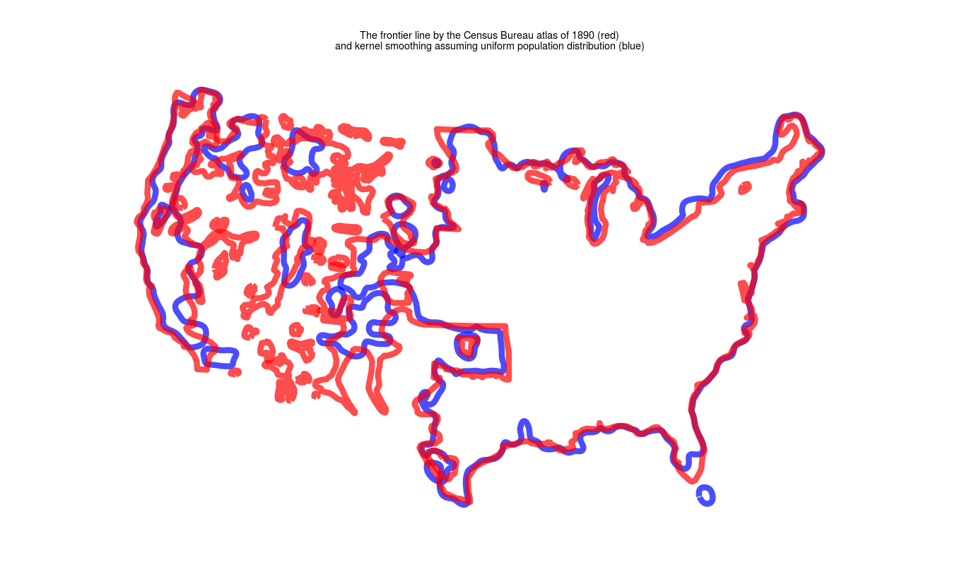
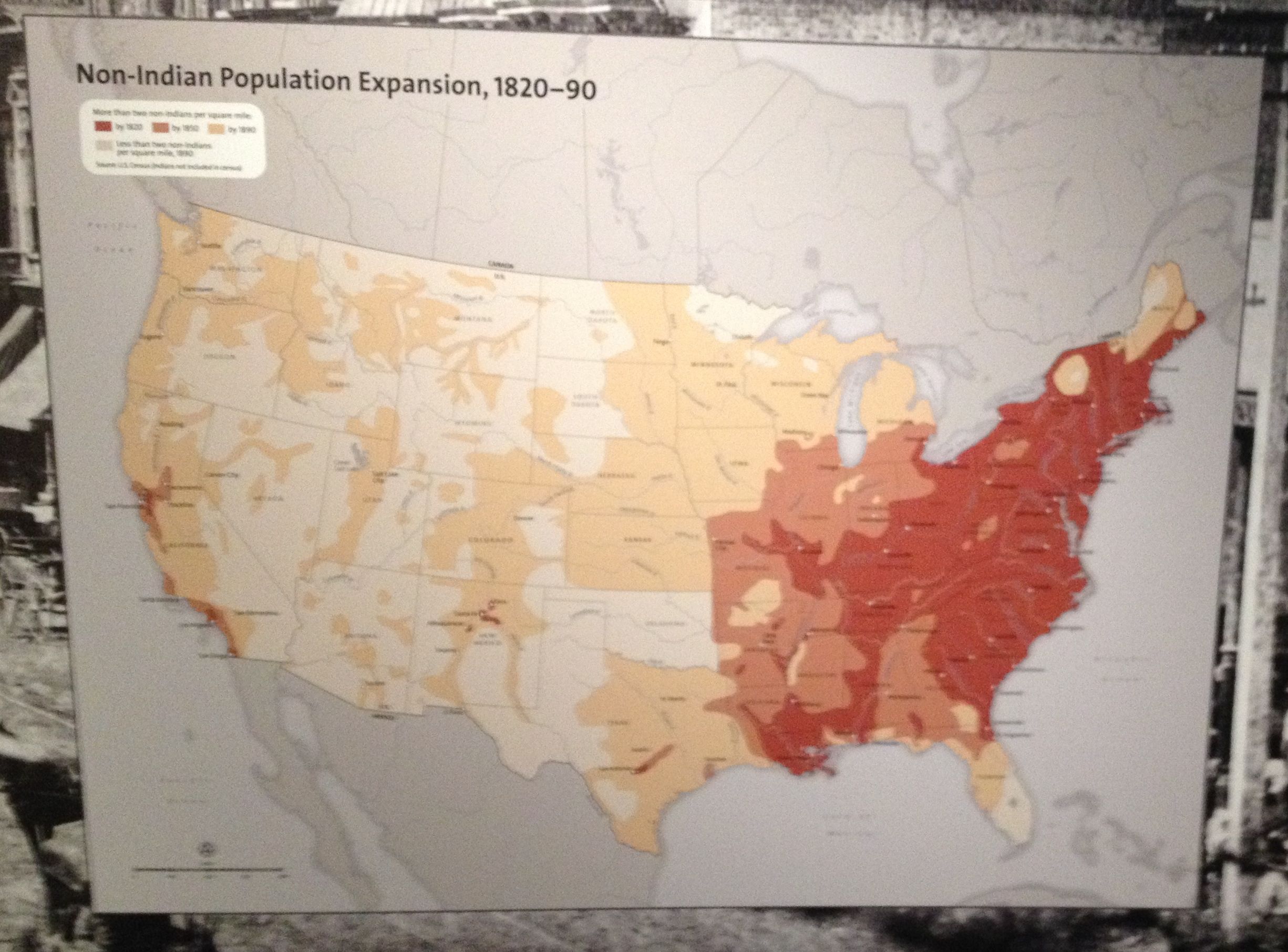
In a recent bulletin of the Superintendent of the Census for 1890 appear these significant words: "Up to and including 1880 the country had a frontier of settlement, but at present the unsettled area has been so broken into by isolated bodies of settlement that there can hardly be said to be a frontier line. In the discussion of its extent, its westward movement, etc., it can not, therefore, any longer have a place in the census reports." This brief official statement marks the closing of a great historic movement. Up to our own day American history has been in a large degree the history of the colonization of the Great West.

1790

1800

1810

1820

1830

1840

1850

1860

1870

1880

1890

Francis Amasa Walker, Census superintendent 1870 & 1880

Why revisualize?

1880

1890

Georeferencing and training

Census frontiers (red) vs county boundaries

1900

1870 Census atlas, detail

Raw templates for sending maps to printer, 1900 census (National Archives)

County data, 1930(?) atlas: National Archives

Why the rush to close the frontier?

Madison Grant, Passing of the Great Race, 1916

Closing of Indian Country

National Museum of the American Indian, 2014

Constructing authority: The Center of Population

Mean Center of Population, US Census Bureau

Median vs Mean: US census Bureau vs. Birmingham Bank

Calculating the Center of New Jersey

Center of Population of the Southern States, Population matrix (National Archives)

Calculating centroids from paper

The 1890 Census

Humanities Data Visualization

Shipping routes

Questions digital humanists get:

  1. What does this tell us that we didn't know before?
  2. How do you know that the data you're looking at are representative?