Seeing Like a State

Seeing Like a State

Scott: State Simplifications are:

  • Interested, utilitarian facts
  • Written, documentary facts.
  • static facts.
  • standardized facts made to lay along a scale or continuum

... while Mr. Obama liked policy option papers that were three to six single-spaced pages, council staff members are now being told to keep papers to a single page, with lots of graphics and maps.

“The president likes maps,” one official said.

-- Schmitt, David E. Sanger, Eric, and Peter Baker. “Turmoil at the National Security Council, From the Top Down.” The New York Times, February 12, 2017.

Census Atlases

Canonical Visualizations in viz field:

2007 Census Atlas reproductions

"Modern" Census Atlas by Nathan Yau

Brooklyn Brainery Christmas Gifts

Jim Vallandingham Census Bump Charts

Canonical Visualizations in history

In a recent bulletin of the Superintendent of the Census for 1890 appear these significant words: "Up to and including 1880 the country had a frontier of settlement, but at present the unsettled area has been so broken into by isolated bodies of settlement that there can hardly be said to be a frontier line. In the discussion of its extent, its westward movement, etc., it can not, therefore, any longer have a place in the census reports." This brief official statement marks the closing of a great historic movement. Up to our own day American history has been in a large degree the history of the colonization of the Great West.

1790

1800

1810

1820

1830

1840

1850

1860

1870

1880

1890

Lies

Misleading features:

  1. 2 people per square mile isn't meaningful.
  2. Who gets counted as a person?
  3. Scales are coloration are designed to mislead.
  4. They don't actually show settlement at 2 per square mile.

Population Density Map, 1870

Whale Populations

The US state sees square miles

Public Land system

1870 Census atlas, detail

The maps of the census reports show an uneven advance of the farmer's frontier, with tongues of settlement pushed forward and with indentations of wilderness. In part this is due to Indian resistance, in part to the location of river valleys and passes, in part to the unequal force of the centers of frontier attraction.

Turner, Significance

1900

Census bureau account of curved lines.

In cases, however, where the county was of unusual extent, or there was reason to believe that its density differed greatly in different parts, the county has been no longer taken entire, but has been examined by sections, even sections as small as its townships or other civil divisions. The number of counties thus broken up for the purpose of comparison would naturally vary greatly. In some census years, as in the case of the later ones, it would amount to several hundred; in others, particularly the earlier ones, to scarcely as many score.

Georeferencing and training

Counties

Raw templates for sending maps to printer, 1900 census (National Archives)

County data, 1930(?) atlas: National Archives

Why Lie?

Republicans rig the electoral college, 1892

The census takers were caught up in the speculative bubble of the 90s.

Bureau of Land Management grants, by authority

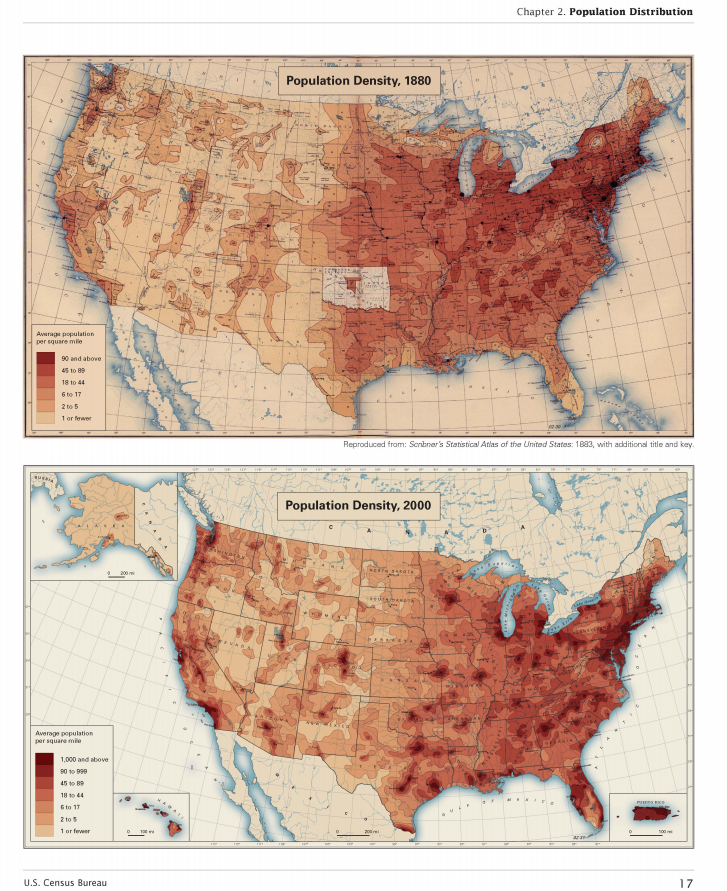
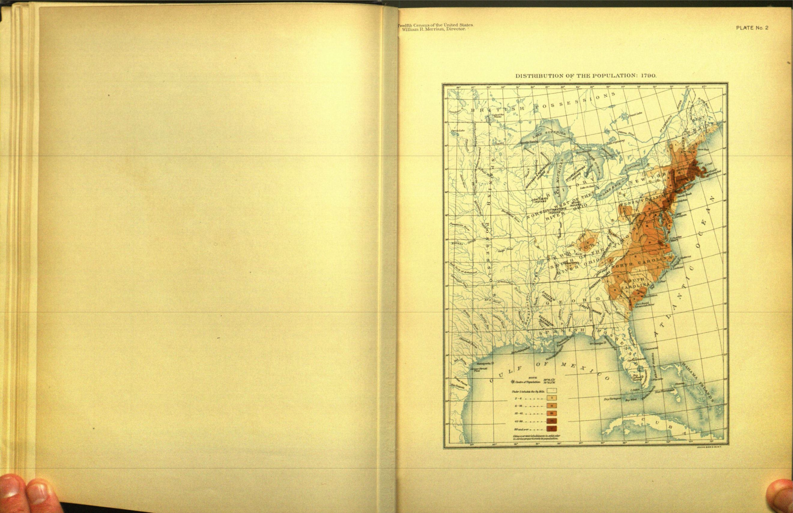
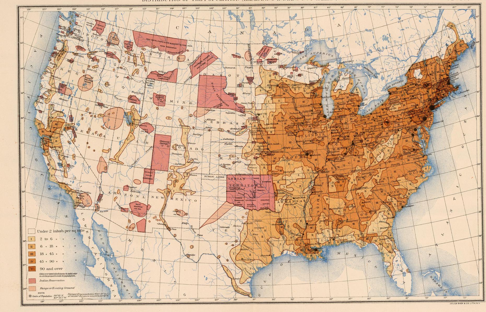
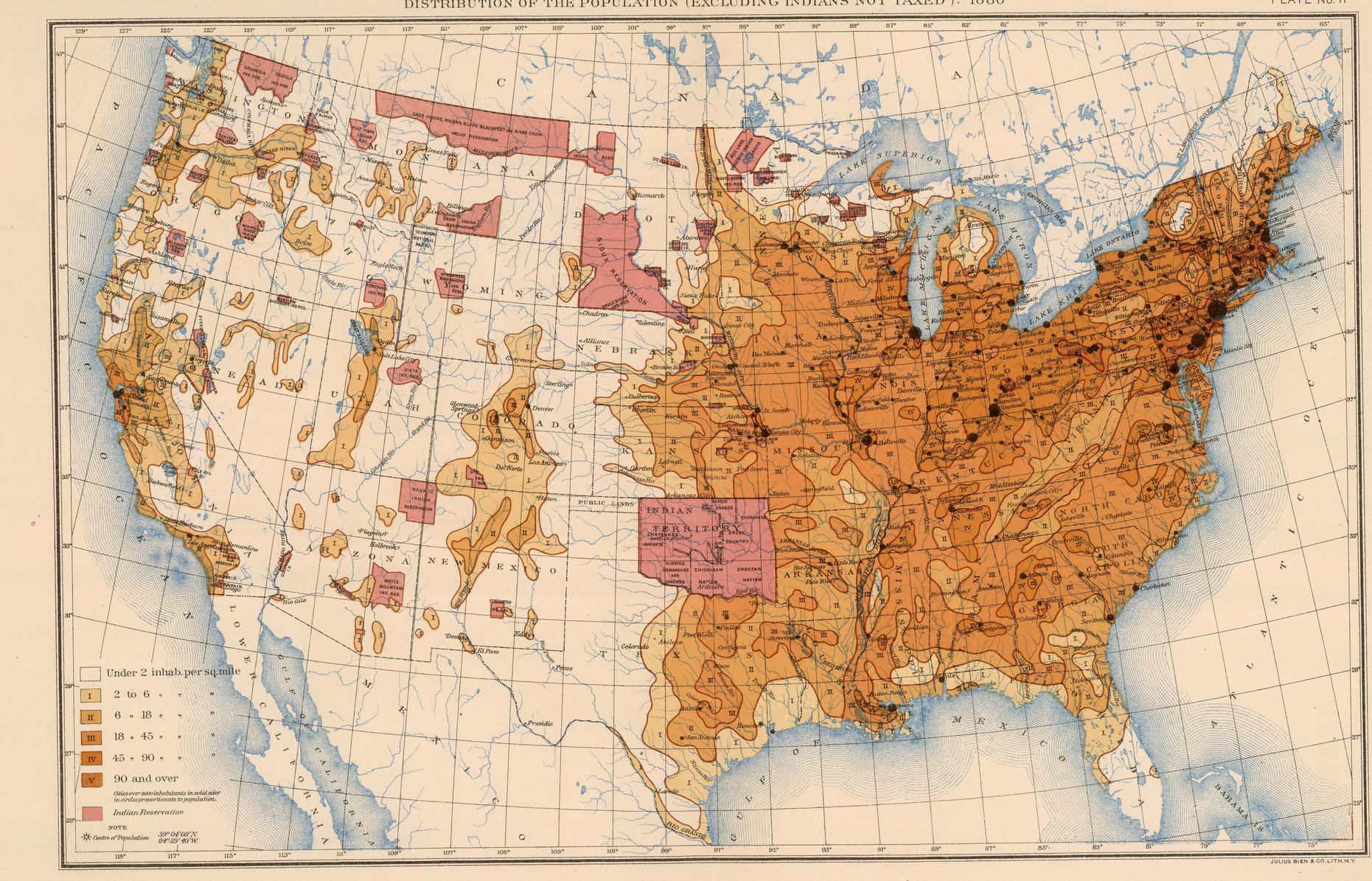
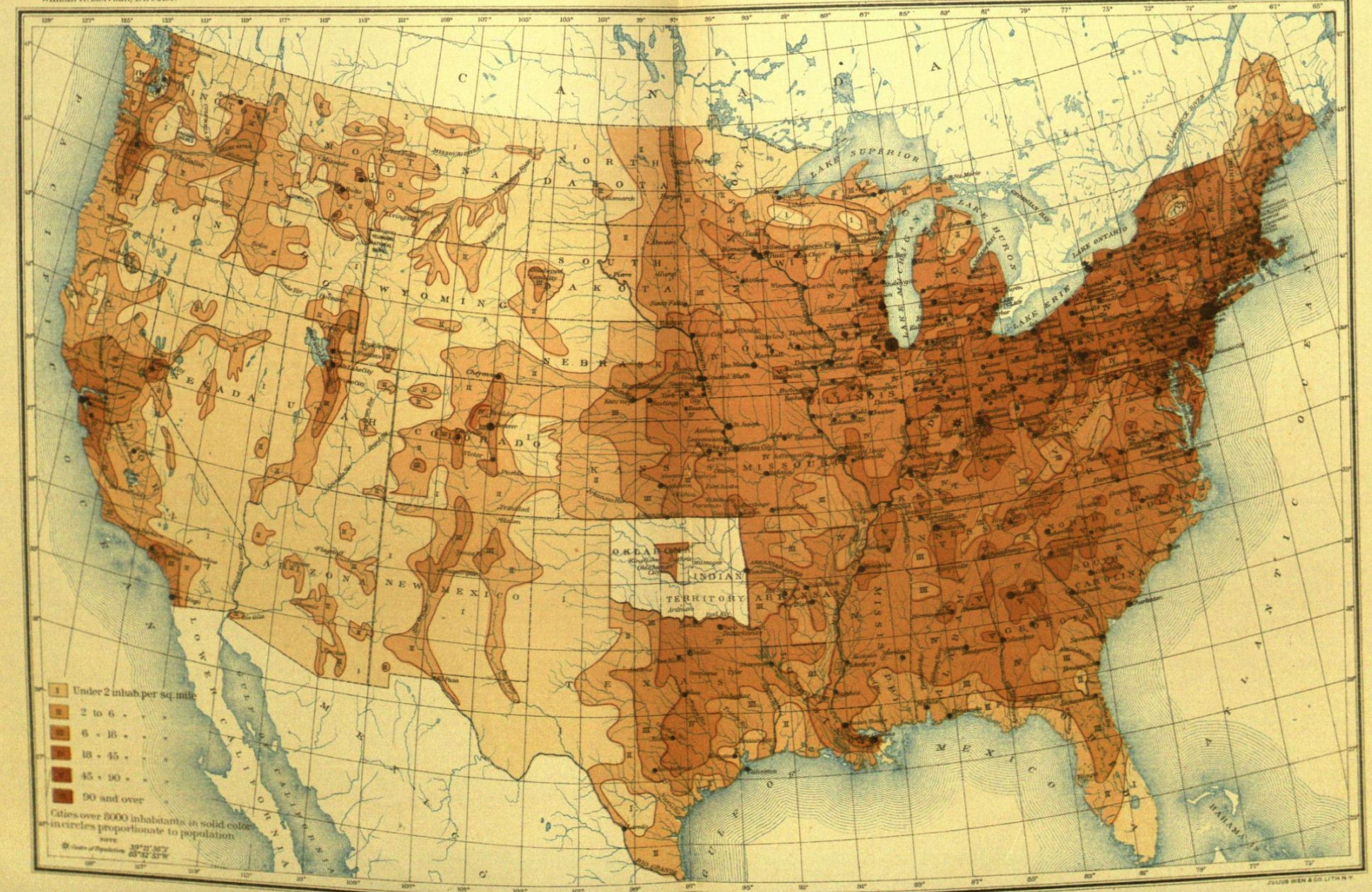
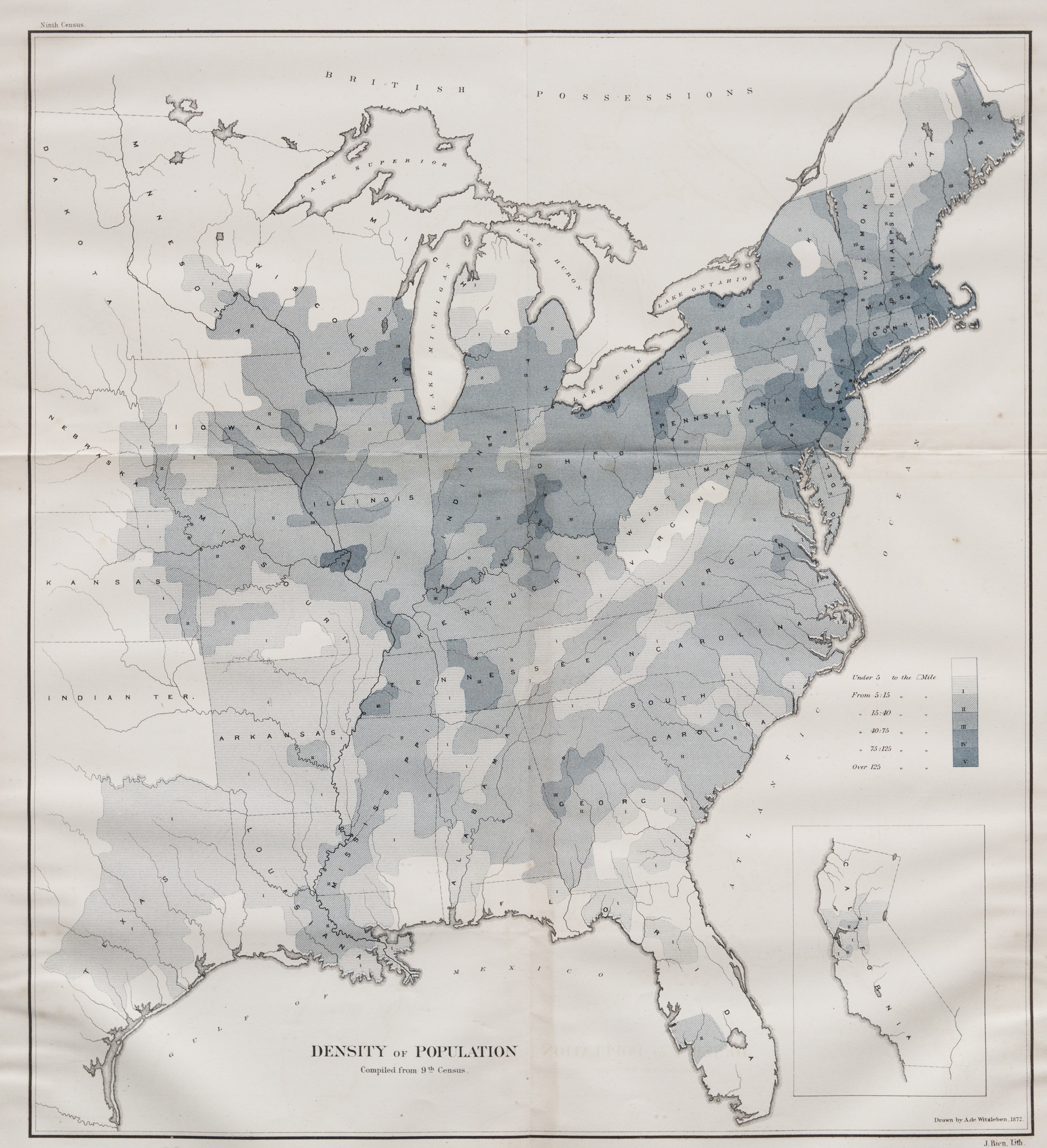
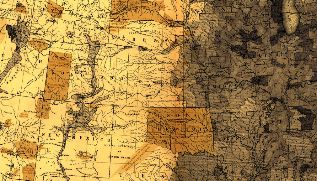
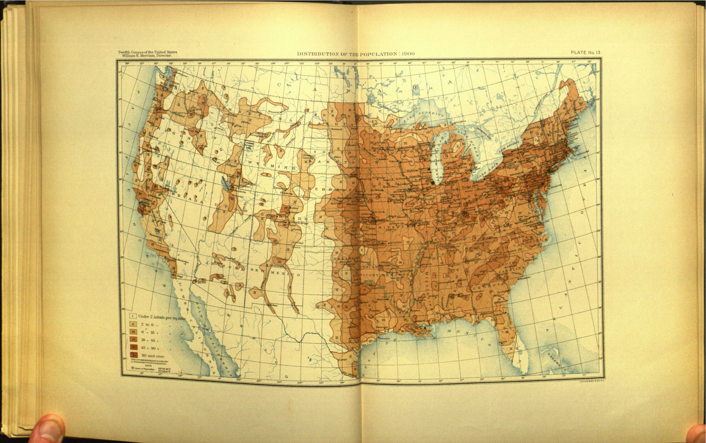
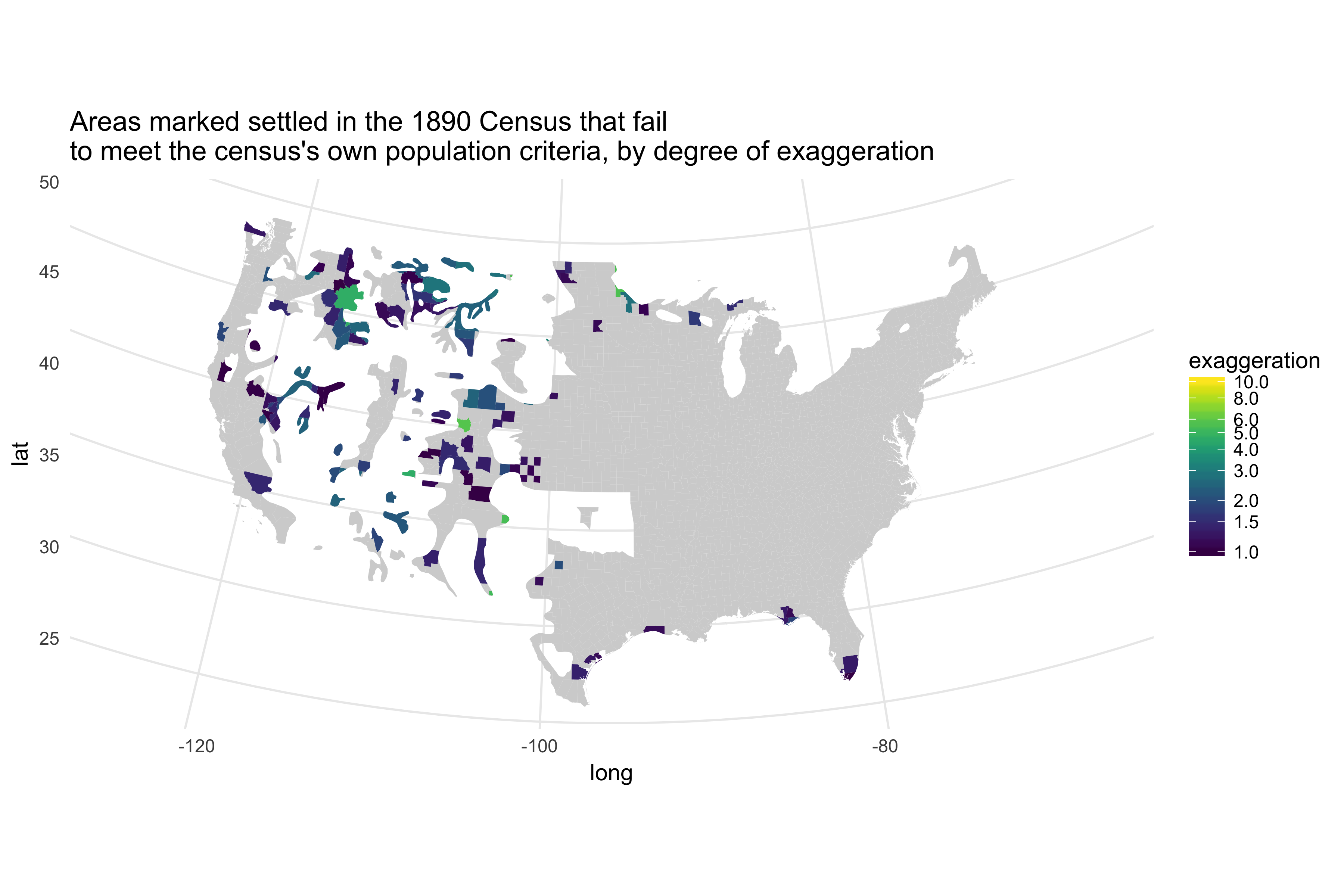
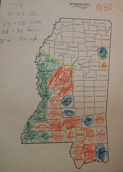
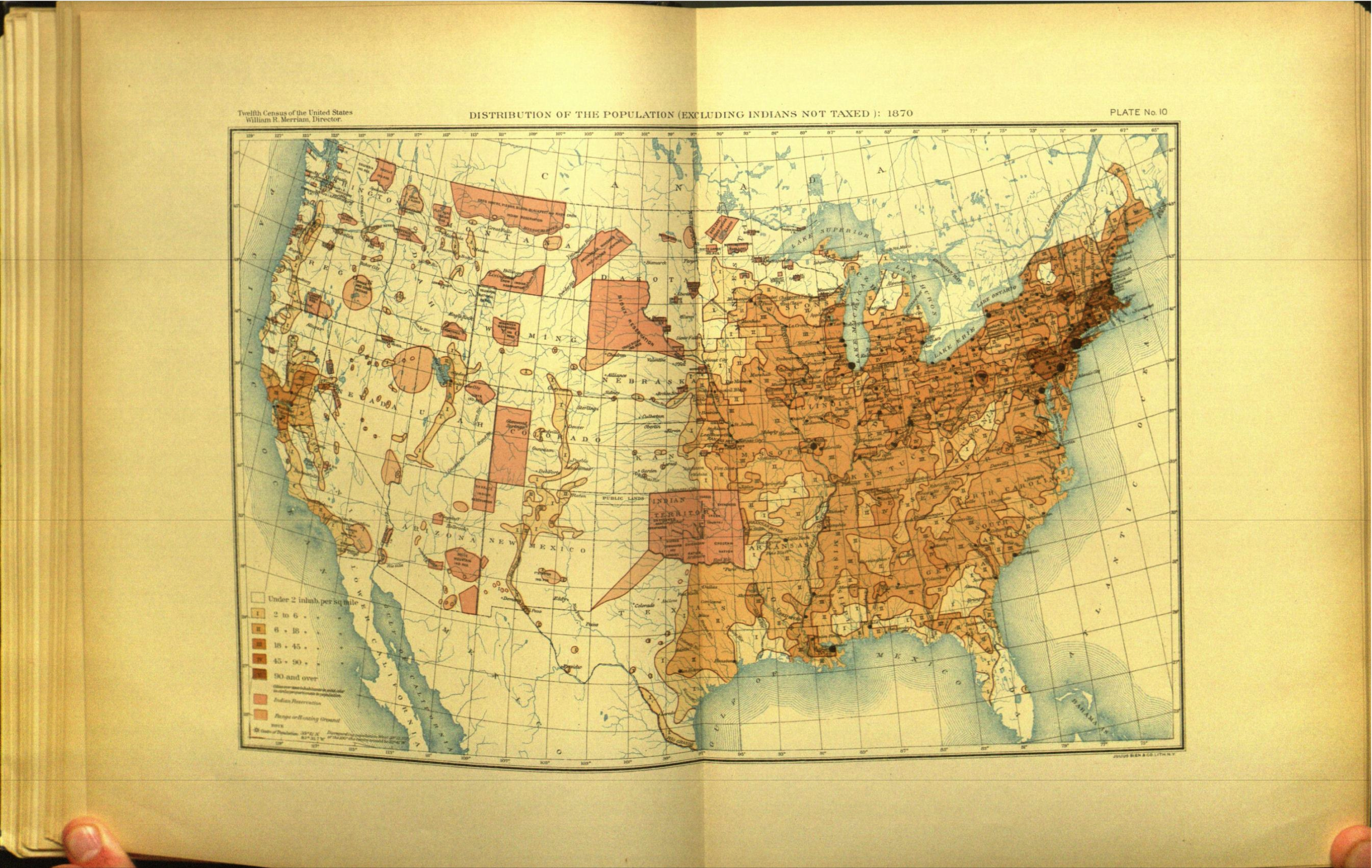
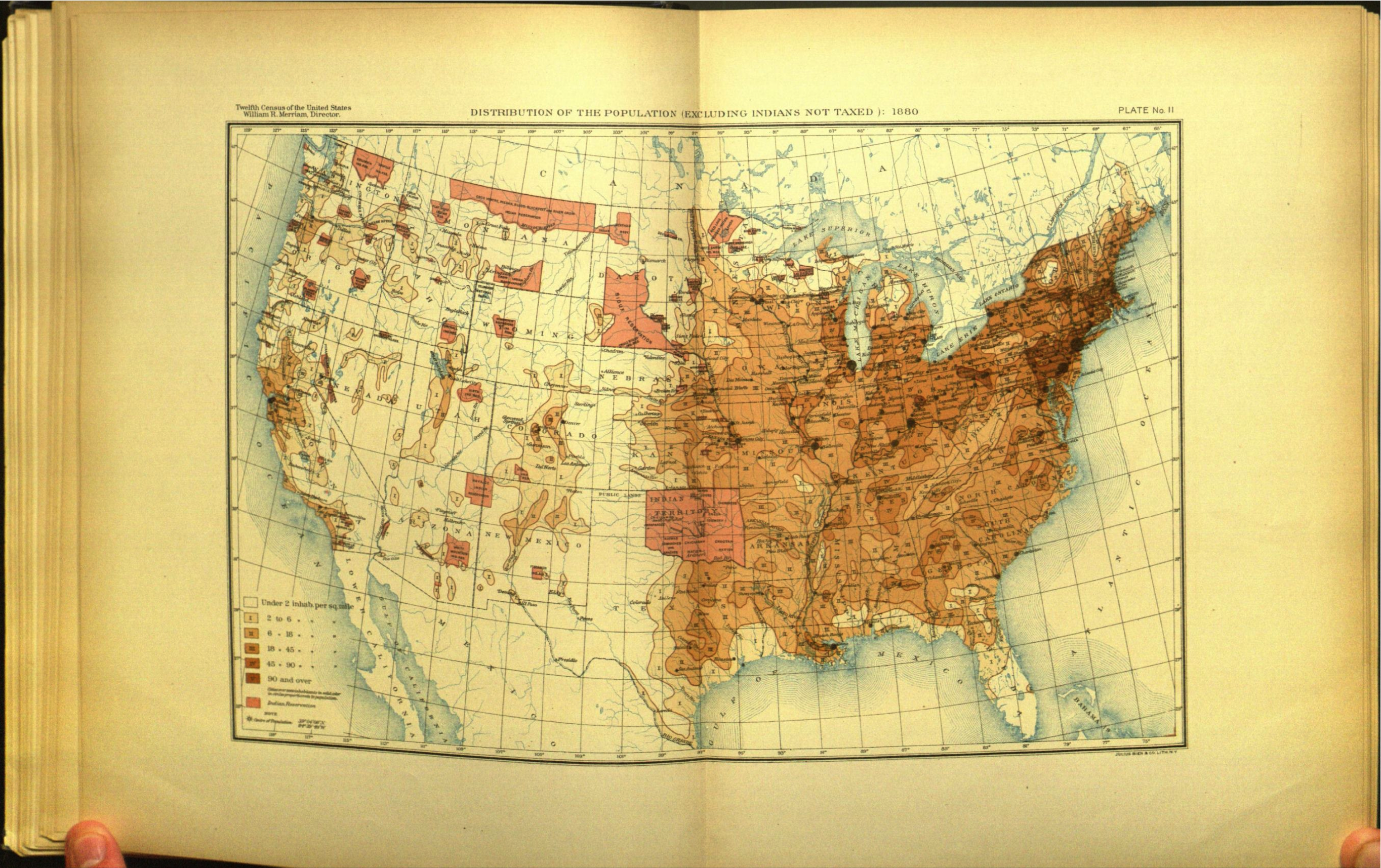
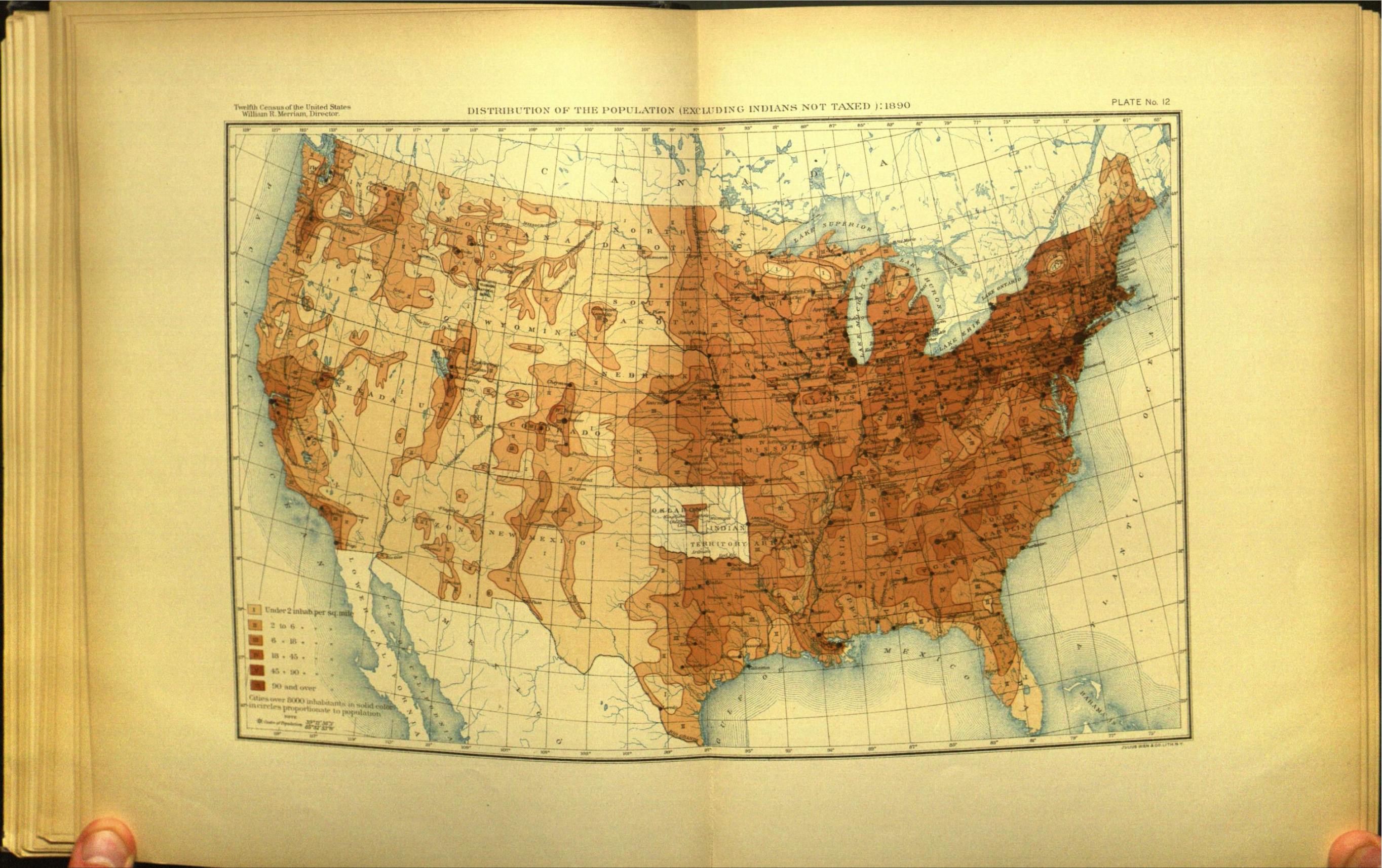
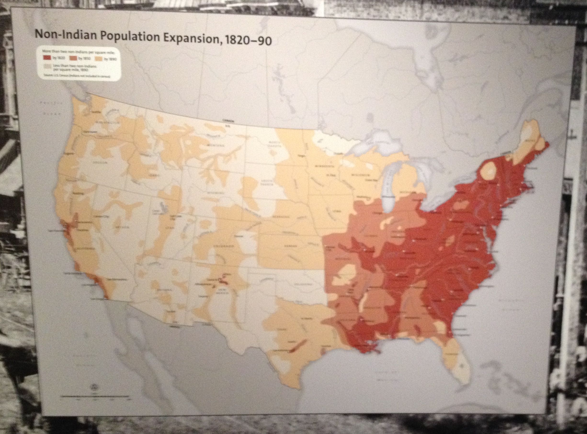
"Since 1868, when the trans-continental railroad was completed, population has found its way into regions to which the rate of progress previously maintained would not in fifty years have carried it,--into nooks and corners which five years ago were scarcely known to trappers and guides. Instead of exposing to Indian contact, as heretofore, a clearly defined frontier line, upon two or three faces, our settlements have penetrated the Western country in every direction and from every direction, creeping along the course of every stream, seeking out every habitable valley, following up every indication of gold among the ravines and moutains, clinging around the reservations of themost formidable tribes, and even making lodgement at a hundred points on land secured by treaty to the Indians."

Walker, Indian Question, 1873

"Fed and clothed by our paternal government, why should they turn the hand to the plow? The streams run to waste; the rich soil remains untilled; the rich ores and the coal lie undisturbed in mother earth."

Henry Gannett, Census Geographer, on the Utes.

1870

1880

1890

Immigration

Help!

  1. The historical profession has been unable to process visualizations critically as subjects; both in the Turner era, and today.

National Museum of the American Indian, 2014

  1. Don't confuse beauty for truth.
  1. To understand the 19th and 20th centuries as policty, we need to place visual sources at the center of debates on things like immigration restriction.

Madison Grant, Passing of the Great Race, 1916

  1. We need counter-visualizations coming out of history as much as we need counter-narratives.

Burning through land